

Diese Seite benötigt for die Shop-Funktionalität Cookies, außerdem setzen wir Marketing-Cookies ein. Mehr Informationen gibt es hier: Datenschutzerlärung
George Row
I’ve been a computer programmer in the telecoms industry, a computer science academic, an online-media producer, but I have always been a Photographer – at present I am specialising in Panoramic Photography.
What I like about panoramic photography is that after almost a decade of composing panoramic images I am still learning about it!
Originally my 360° panoramas were only accessible as immersive virtual reality images on the computer. Over the last few years I have been experimenting with ways of making prints of those panoramas.
About > Activities
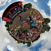
George Row
hat das Bild
Teenage kicks - The Undertones play Brooke Park
hochgeladen
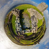
George Row
hat das Bild
O'Brien Fort Inisheer, Aran Islands, Ireland
hochgeladen
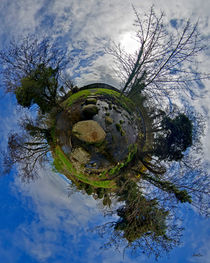
George Row
hat das Bild
Stepping Stones Across Kilkeel River, County Down
hochgeladen
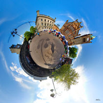
George Row
hat das Bild
Walled City Market, Derry
hochgeladen
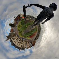
George Row
hat das Bild
Hands Across the Divide, Derry
hochgeladen