Diese Seite benötigt for die Shop-Funktionalität Cookies, außerdem setzen wir Marketing-Cookies ein. Mehr Informationen gibt es hier: Datenschutzerlärung
- Maks Erlikh
- BRYCE CANYON
Bryce Canyon National Park is located in southwestern Utah about 50 miles (80 km) northeast of and 1,000 feet (300 m) higher than Zion National Park.[4][5] The weather in Bryce Canyon is therefore cooler, and the park receives more precipitation: a total of 15 to 18 inches (38 to 46 cm) per year.[6][7] Yearly temperatures vary from an average minimum of 9 °F (?13 °C) in January to an average maximum of 83 °F (28 °C) in July, but extreme temperatures can range from ?30 °F to 97 °F (?34 °C to 36 °C).[7] The record high temperature in the park was 98 °F (37 °C) on July 14, 2002. The record low temperature was ?28 °F (?33 °C) on December 10, 1972.[8]
The national park lies within the Colorado Plateau geographic province of North America and straddles the southeastern edge of the Paunsagunt Plateau west of the Paunsagunt Fault (Paunsagunt is Paiute for "home of the beaver").[9] Park visitors arrive from the plateau part of the park and look over the plateau's edge toward a valley containing the fault and the Paria River just beyond it (Paria is Paiute for "muddy or elk water"). The edge of the Kaiparowits Plateau bounds the opposite side of the valley.
Bryce Point
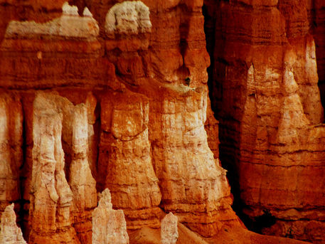
Bryce Canyon was not formed from erosion initiated from a central stream, meaning it technically is not a canyon. Instead headward erosion has excavated large amphitheater-shaped features in the Cenozoic-aged rocks of the Paunsagunt Plateau.[9] This erosion exposed delicate and colorful pinnacles called hoodoos that are up to 200 feet (61 m) high. A series of amphitheaters extends more than 20 miles (32 km) north-to-south within the park.[9] The largest is Bryce Amphitheater, which is 12 miles (19 km) long, 3 miles (4.8 km) wide and 800 feet (240 m) deep.[9] A nearby example of amphitheaters with hoodoos in the same formation but at a higher elevation, is in Cedar Breaks National Monument, which is 25 miles (40 km) to the west on the Markagunt Plateau.[5]
Rainbow Point, the highest part of the park at 9,105 feet (2,775 m),[10] is at the end of the 18-mile (29 km) scenic drive.[9] From there, Aquarius Plateau, Bryce Amphitheater, the Henry Mountains, the Vermilion Cliffs and the White Cliffs can be seen. Yellow Creek, where it exits the park in the north-east section, is the lowest part of the park at 6,620 fee


